
It’s been about a week since we’ve seen measurable precipitation in Boston, and that streak won’t end today! We’ve started out nice and sunny this morning, and we’ll keep the sunshine around through most of the day. Expect some clouds to filter in later this afternoon, but not much more than that.
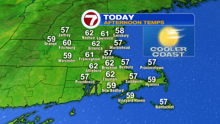
In terms of temperatures, we’ll work our way up through the 30s and 40s, all the way to the upper 50s and low 60s this afternoon. It’ll be the 16th day of above-average temperatures this month– feeling much more like early to mid-October rather than late November.
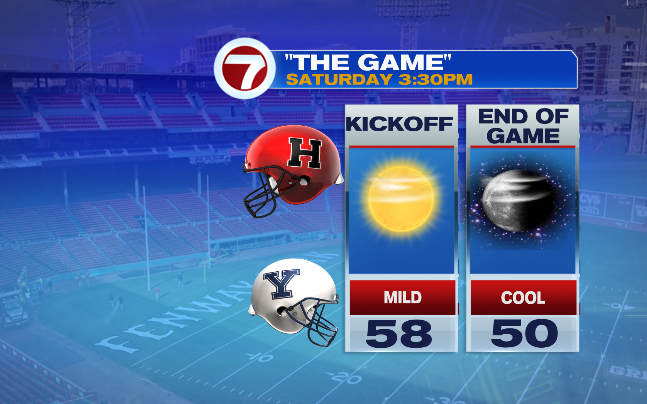
It’s great news for anyone who likes the mild air, or anyone who’s just hoping for a dry day outside. That includes everyone headed to Fenway for The Game– Harvard vs. Yale, kicking off at 3:30PM. Temperatures will be in the upper 50s for kickoff, but with sunset at 4:17PM, we’ll cool down quickly as it gets dark in the second half. Expect temps near 50 by the end of the game.
Overnight, temperatures fall back into the 30s for most. We’ll wake up to a very different day on Sunday.
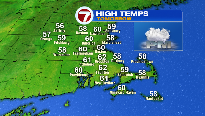
While the morning and early/midafternoon will stay dry, it’ll be considerably cloudier. Highs will still be mild, with temps hitting the low 60s once again.
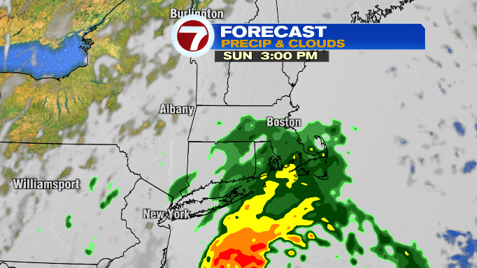
However, the main event on Sunday is a storm that will bring us rain, wind and some choppy waves. That energy for that storm is currently making its way north after spending a good deal of time bringing active weather to Florida. It will continue northward, developing into a coastal storm which will bring us rain in the late
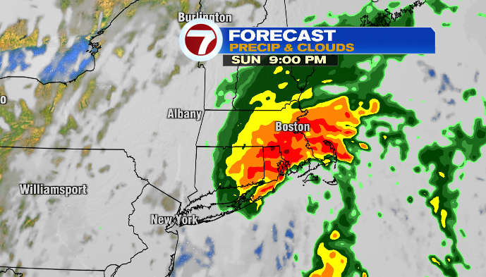
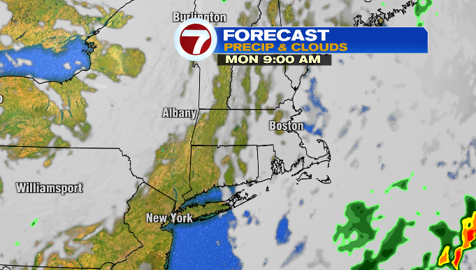
Throughout the evening, we’ll go from showers to widespread, sometimes heavy rain that will linger through Sunday night and into early Monday morning. Rain moves out early Monday morning, and we may see a little sun by the afternoon.
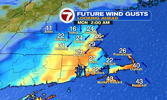
However, it’ll be quite windy during this time as well (particularly Monday morning), with gusts in the 20s and 30s. Gusts in the 40s are possible for the Cape and Islands too.
The storm will also bring choppy waves, and the potential for some coastal splashover during high tide on Monday morning.
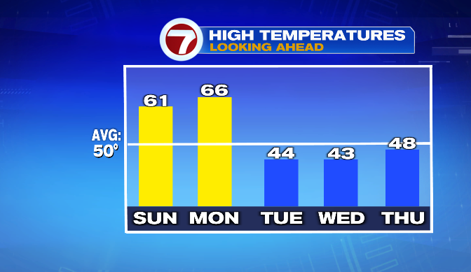
The storm gets an extra nudge eastward on Monday thanks to an incoming cold front. The air after our storm and behind the front is dramatically cooler. With that, we’ll go from highs in the low to mid 60s on Monday, to highs only in the low to mid 40s on Tuesday. The cooler weather clings from there– high temperatures will remain in the 40s for the rest of the week, giving us a much more November-like, even early December-like feel.
The cooler trend includes Thanksgiving day. On top of that, another storm could make its way into Southern New England just in time for the holiday. Right now, Thanksgiving day, and Friday morning are both looking wet. Rain will be the main feature of this storm, but there is a chance that we could see some winter weather mixing in for higher elevation areas (though at this point, this looks much more likely for areas of VT/NH… good for the skiers looking to get the season going). We’ll continue to update you on this storm throughout the week!


